Land use (technically called “land use/land cover”) can be classified in many ways. For our study, we assigned each square meter of surface in the Rivanna basin to one of the following categories:
- Impervious
- Forest (with subclassifications: deciduous, evergreen, pine plantation, and cut-over)
- Open land
- Golf course
- Vineyard
- Orchard
- Bare earth
- Water
What is Impervious Cover?
Impervious cover refers to a surface that does not allow the infiltration of water, such as roads, buildings, parking lots, and sidewalks.
Land Use Map
As a whole, the Rivanna basin is about 70% forested and about 3% impervious. But, as shown in the map below, Rivanna land use is not uniform.
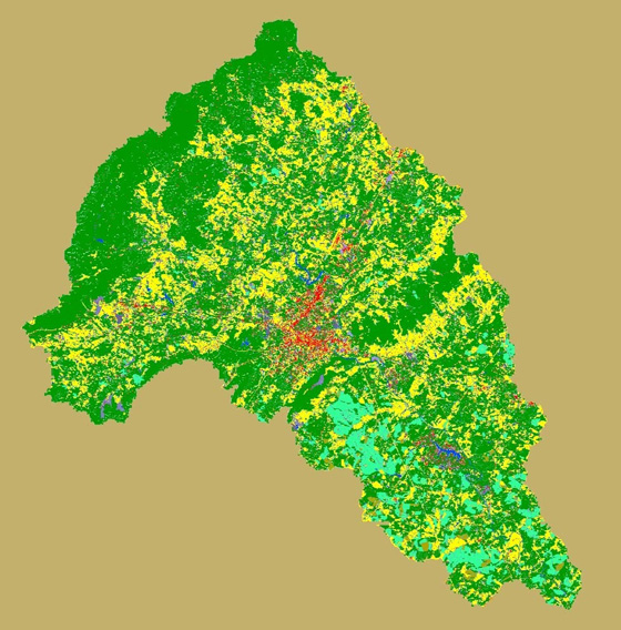
Land use and land cover vary widely in the Rivanna basin. Impervious cover (red) is prominent in highly developed areas such as Charlottesville and Lake Monticello. Some pockets are heavily forested (green). Much of the basin is a patchwork of forest and field (yellow), interspersed with light to moderate development. Teal areas are loblolly pine plantations.
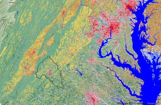
Above: Land use/land cover throughout the lower Chesapeake Bay watershed. The mixed land use of the Rivanna basin (outlined in black) is fairly typical of the Chesapeake Bay region. The intense urbanization of the D.C./Baltimore area is visible to the upper right. Richmond is visible to the lower right.